Official Plan, Neighbourhood Plans, and Zoning
Three City of Hamilton documents provide context about the current vision and rules around development in the neighbourhood.
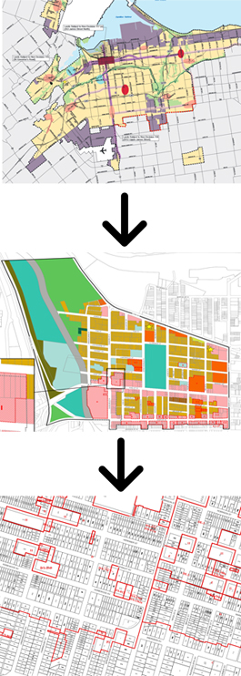
The Official Plan (OP) is the overarching blueprint for planning in the City of Hamilton. The OP provides a higher level vision for areas within the city, including Durand. The most recent OP was enacted in 2013 and speaks in broader terms about a vision for neighbourhoods. For more information on the Official Plan, click here.
Secondary Plans provide a more geographically specific vision for an area or neighbourhood. Secondary Plans should be consistent with the Official Plan, providing more detail on how a neighbourhood should grow and develop. The most recent neighbourhood plan for Durand is from 1987, making it inconsistent with the contemporary neighbourhood and the newest Official Plan. An updated plan for the neighbourhood is scheduled to be undertaken in the coming years.
The Zoning By-law provides the property-by-property rules for development across the city, for all land use types (e.g. residential, commercial, industrial, etc.). Zoning helps enact the broader goals for the neighbourhood and therefore should be consistent with the Secondary Plan and Official Plan. While an update to the Hamilton Zoning by-law is underway, the current by-law is from the pre-amalgamated City of Hamilton.
The Durand Character Zoning Project is focussed on this level of planning for the neighbourhood.