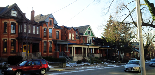
Streetscape Character Analysis of Robinson Street
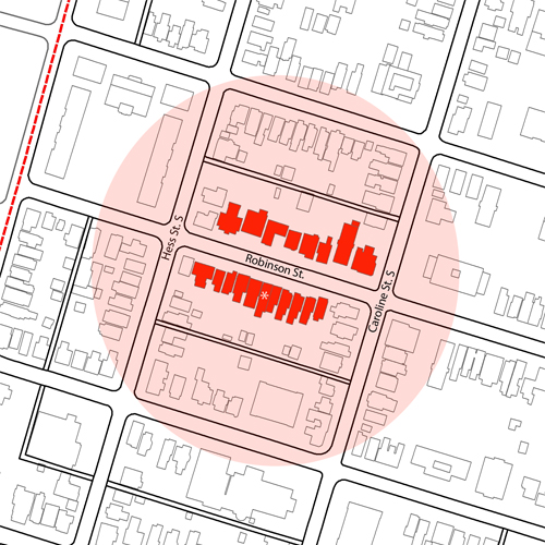
This Streetscape Character Analysis (SCA) is focussed on Robinson Street, a street in the centre of the Durand neighbourhood, which runs from West to East from Queen Street South to James St. S. The block included in the analysis sits between Hess St. S and Caroline St. S. The streetscape is made up of mostly intact Victorian housing of up to three stories in height. The house marked with a * indicates the reference house for the analysis.
The SCA for this area demonstrates that the dominant character is A-A-A. See below for details on how this was determined.
| Front Yards | ||
|---|---|---|
| Number of Houses | Dominant Character | |
| Group A: Fully landscaped yard | 18 | X |
| Group B: Landscaped in front of the house width only | 0 | |
| Group C: Landscaped in front of part of the house | 0 | |
| Group D: Small or no landscaped yard | 0 |
| Parking and Driveways | ||
|---|---|---|
| Number of Houses | Dominant Character | |
| Group A: No streetscape impact from on-site parking | 18 | X |
| Group B: Low streetscape impact from on-site parking | 0 | |
| Group C: Medium streetscape impact from on-site parking | 0 | |
| Group D: High streetscape impact from parking | 0 |
| Main Door | ||
|---|---|---|
| Number of Houses | Dominant Character | |
| Group A: Main door facing the street | 17 | X |
| Group B: Main door does not face the street | 1 |